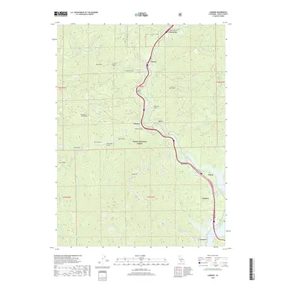
2018 Map of Lamoine
USGS Topo · Published 2018About this map
Sacramento River canyons dominate this northern California landscape, which follows the river's winding course as it feeds into the northern reaches of Shasta Lake. This modern survey illustrates the proximity of mountain settlements like Lamoine, Pollard Flat, and Vollmers to the steep terrain of the Shasta National Forest. The map captures a corridor defined by significant elevation changes, from the heights of Mosquito Creek Ridge and Sugarloaf down to the drainage basins of Slate Creek and Dog Creek. Near the southern edge of the sheet, the developments at Lakehead and Lakeshore mark the interface between the wooded uplands and the reservoir's shoreline. The topography is etched with numerous gulches, including Clarks Gulch and French Gulch, which speak to the area's history of resource extraction and rugged drainage patterns.
Find a feature on this map
48 named features on this map. Tap any name to fly to it.
Don’t see what you’re looking for? This feature index may not catch every label — zoom into the map to look around manually.
Map Details
Editions of this 2018 Lamoine Map
This is the sole edition of this map. No revisions or reprints were ever made.
Other maps of this area

1886 · Shasta
USGS Topo · 1:250,000

1890 · Red Bluff
USGS Topo · 1:250,000

1894 · Red Bluff
USGS Topo · 1:250,000

1894 · Shasta
USGS Topo · 1:250,000

1901 · Redding
USGS Topo · 1:125,000

1913 · Weaverville
USGS Topo · 1:125,000

1923 · Sawyers Bar
USGS Topo · 1:125,000

1931 · Etna
USGS Topo · 1:96,000

1934 · Etna
USGS Topo · 1:125,000

1935 · Dunsmuir
USGS Topo · 1:125,000