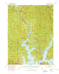
1969 Map of Lamoine
USGS Topo · Published 1974About this map
The Sacramento River and McCloud River valleys define this Northern California landscape during a period of significant recreational development following the construction of Shasta Dam. By the late 1960s, the rising waters of Shasta Lake have created a complex shoreline of inlets and bays, such as Hirz Bay and Packers Bay, while established communities like Lakehead and Delta serve as hubs for the burgeoning Whiskeytown-Shasta-Trinity National Recreation Area.
Find a feature on this map
121 named features on this map. Tap any name to fly to it.
Don’t see what you’re looking for? This feature index may not catch every label — zoom into the map to look around manually.
Map Details
Editions of this 1969 Lamoine Map
This is the sole edition of this map. No revisions or reprints were ever made.
Other maps of this area

1886 · Shasta
USGS Topo · 1:250,000

1890 · Red Bluff
USGS Topo · 1:250,000

1894 · Red Bluff
USGS Topo · 1:250,000

1894 · Shasta
USGS Topo · 1:250,000

1901 · Redding
USGS Topo · 1:125,000

1913 · Weaverville
USGS Topo · 1:125,000

1923 · Sawyers Bar
USGS Topo · 1:125,000

1931 · Etna
USGS Topo · 1:96,000

1934 · Etna
USGS Topo · 1:125,000

1935 · Dunsmuir
USGS Topo · 1:125,000