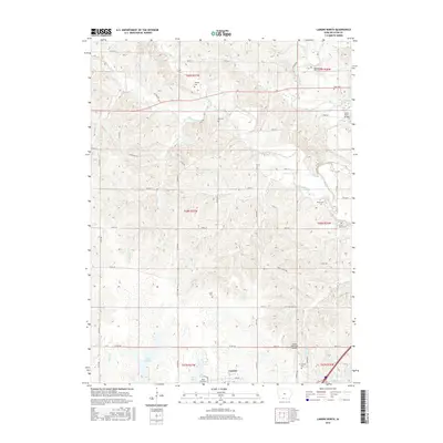
2015 Map of Lamoni North
USGS Topo · Published 2015About this map
Lamoni and the surrounding Decatur County countryside are defined by a complex network of waterways feeding into the Thompson River. The landscape is heavily marked by small rural cemeteries, suggesting a legacy of early family farmsteads and pioneer-era settlements across the townships. Many of these, such as Millsap Cem, Bucy Cem, and the Woodmansee Cem in the northeast, are located well away from modern hubs. North of the town center, Lake LaShane and Home Lake provide focal points for local water management and recreation. Transportation in the mid-2010s relied on a grid of county roads, including Co RD r14 and Terre Haute Rd, while the Lamoni Municipal Airport serves as a regional aviation link. The Grand River Bridge spans the river in the northeast corner, connecting this agricultural corridor to the adjacent townships.
Find a feature on this map
60 named features on this map. Tap any name to fly to it.
Don’t see what you’re looking for? This feature index may not catch every label — zoom into the map to look around manually.
Map Details
Editions of this 2015 Lamoni North Map
This is the sole edition of this map. No revisions or reprints were ever made.
Other maps of this area

1945 · Mount Ayr
USGS Topo · 1:62,500

1945 · Lamoni
USGS Topo · 1:62,500

1947 · Lamoni
USGS Topo · 1:62,500

1947 · Mount Ayr
USGS Topo · 1:62,500

1954 · Centerville
USGS Topo · 1:250,000

1955 · Nebraska City
USGS Topo · 1:250,000

1957 · Nebraska City
USGS Topo · 1:250,000

1957 · Centerville
USGS Topo · 1:250,000

1958 · Centerville
USGS Topo · 1:250,000

1958 · Nebraska City
USGS Topo · 1:250,000