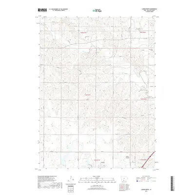
2018 Map of Lamoni North
USGS Topo · Published 2018About this map
The rolling agricultural landscape north of Lamoni is defined by a dense network of country roads and small family cemeteries that trace the settlement patterns of Decatur County. Multiple burial grounds, including Millsap Cem, Cash Cem, and the Woodmansee Cem, are tucked away near the headwaters of Elk Creek and West Elk Creek. These small sites suggest a history of decentralized rural communities that once thrived along the creek bottoms before modern consolidation. To the east, the Thompson River meanders toward the Grand River Bridge, while the southern edge of the survey captures the northern expansion of Lamoni, anchored by the Lamoni Municipal Airport and the recreational waters of Home Lake and Home Pond. This modern survey provides a detailed view of the section lines and rural infrastructure that continue to shape the land long after the original homesteading era.
Find a feature on this map
59 named features on this map. Tap any name to fly to it.
Don’t see what you’re looking for? This feature index may not catch every label — zoom into the map to look around manually.
Map Details
Editions of this 2018 Lamoni North Map
This is the sole edition of this map. No revisions or reprints were ever made.
Other maps of this area

1945 · Mount Ayr
USGS Topo · 1:62,500

1945 · Lamoni
USGS Topo · 1:62,500

1947 · Lamoni
USGS Topo · 1:62,500

1947 · Mount Ayr
USGS Topo · 1:62,500

1954 · Centerville
USGS Topo · 1:250,000

1955 · Nebraska City
USGS Topo · 1:250,000

1957 · Nebraska City
USGS Topo · 1:250,000

1957 · Centerville
USGS Topo · 1:250,000

1958 · Centerville
USGS Topo · 1:250,000

1958 · Nebraska City
USGS Topo · 1:250,000