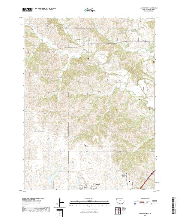
2022 Map of Lamoni North
USGS Topo · Published 2022About this map
Lamoni anchors the southern edge of this Decatur County landscape, where the northern expansion of the community meets a patchwork of rolling farm tracts and winding waterways. The Thompson River flows through the eastern portion of the quadrangle, joined by tributaries such as Elk Creek and Pot Hole Cr. This 2022 survey documents a rural infrastructure defined by a dense network of country roads, including Terre Haute Rd and Elk Chapel Rd, which connect numerous family and community burial grounds. Genealogists will find a wealth of named sites such as Woodmansee Cem, Cash Cem, and Rose Hill Cem. The area surrounding the Lamoni Municipal Airport and Home Lake reflects the modern transition from the town's residential core to the agricultural expanses of the northern townships.
Find a feature on this map
61 named features on this map. Tap any name to fly to it.
Don’t see what you’re looking for? This feature index may not catch every label — zoom into the map to look around manually.
Map Details
Editions of this 2022 Lamoni North Map
This is the sole edition of this map. No revisions or reprints were ever made.
Other maps of this area

1945 · Mount Ayr
USGS Topo · 1:62,500

1945 · Lamoni
USGS Topo · 1:62,500

1947 · Lamoni
USGS Topo · 1:62,500

1947 · Mount Ayr
USGS Topo · 1:62,500

1954 · Centerville
USGS Topo · 1:250,000

1955 · Nebraska City
USGS Topo · 1:250,000

1957 · Nebraska City
USGS Topo · 1:250,000

1957 · Centerville
USGS Topo · 1:250,000

1958 · Centerville
USGS Topo · 1:250,000

1958 · Nebraska City
USGS Topo · 1:250,000