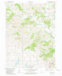
1981 Map of Lamoni North
USGS Topo · Published 1981About this map
Lamoni serves as the southern anchor of this southern Iowa landscape, where the town’s northern reaches give way to the rolling drainage basins of the Grand River and Thompson River. The map captures a transition from town to timbered river breaks, punctuated by a deep rural network of cemeteries and small church congregations. Notable landmarks include Terre Haute and the settlement at Tuskeego, alongside several family-named burial grounds like Lillie Cem and Cash Cem.
Find a feature on this map
40 named features on this map. Tap any name to fly to it.
Don’t see what you’re looking for? This feature index may not catch every label — zoom into the map to look around manually.
Map Details
Editions of this 1981 Lamoni North Map
This is the sole edition of this map. No revisions or reprints were ever made.
Other maps of this area

1945 · Mount Ayr
USGS Topo · 1:62,500

1945 · Lamoni
USGS Topo · 1:62,500

1947 · Lamoni
USGS Topo · 1:62,500

1947 · Mount Ayr
USGS Topo · 1:62,500

1954 · Centerville
USGS Topo · 1:250,000

1955 · Nebraska City
USGS Topo · 1:250,000

1957 · Nebraska City
USGS Topo · 1:250,000

1957 · Centerville
USGS Topo · 1:250,000

1958 · Centerville
USGS Topo · 1:250,000

1958 · Nebraska City
USGS Topo · 1:250,000