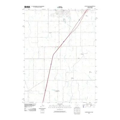
2010 Map of Lamoni South
USGS Topo · Published 2010About this map
Lamoni sits at the northern edge of this Iowa-Missouri border landscape, characterized by a transition from the structured residential grid of the town to a rolling agricultural expanse. The area is defined by the wandering paths of Sevenmile Creek and the East Fork Big Creek, which carve through the farmland alongside Interstate 35. This 2010 survey reveals a quiet rural layout where large-scale watershed management is evident through features like Savely Lake and several dams, including the East Fork Big Creek Watershed Dam A-38. For local historians and genealogists, the map provides precise locations for long-standing community landmarks such as Rose Hill Cemetery and the Sweet Home Cemetery, alongside the small settlement of Andover further east. The persistence of these cemeteries and the Lamoni Post Office anchors the modern geography to its earlier roots.
Find a feature on this map
56 named features on this map. Tap any name to fly to it.
Don’t see what you’re looking for? This feature index may not catch every label — zoom into the map to look around manually.
Map Details
Editions of this 2010 Lamoni South Map
This is the sole edition of this map. No revisions or reprints were ever made.
Other maps of this area

1945 · Mount Ayr
USGS Topo · 1:62,500

1945 · Lamoni
USGS Topo · 1:62,500

1947 · Lamoni
USGS Topo · 1:62,500

1947 · Blythedale
USGS Topo · 1:62,500

1947 · Mount Ayr
USGS Topo · 1:62,500

1948 · Bethany
USGS Topo · 1:62,500

1954 · Centerville
USGS Topo · 1:250,000

1955 · Nebraska City
USGS Topo · 1:250,000

1957 · Nebraska City
USGS Topo · 1:250,000

1957 · Centerville
USGS Topo · 1:250,000