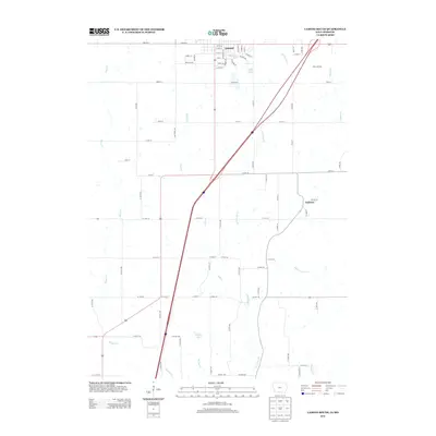
2013 Map of Lamoni South
USGS Topo · Published 2013About this map
Lamoni anchors the northern edge of this landscape, its residential grid defined by streets like W Lincoln and College Ave near the campus grounds. The terrain transitions south from the town's edge into a network of small watersheds, where Founders Lake and Big G Lake provide local water storage. Interstate 35 bisects the region, cutting a diagonal path through the rural countryside toward Giles Junction and beyond.
Find a feature on this map
87 named features on this map. Tap any name to fly to it.
Don’t see what you’re looking for? This feature index may not catch every label — zoom into the map to look around manually.
Map Details
Editions of this 2013 Lamoni South Map
This is the sole edition of this map. No revisions or reprints were ever made.
Other maps of this area

1945 · Mount Ayr
USGS Topo · 1:62,500

1945 · Lamoni
USGS Topo · 1:62,500

1947 · Lamoni
USGS Topo · 1:62,500

1947 · Blythedale
USGS Topo · 1:62,500

1947 · Mount Ayr
USGS Topo · 1:62,500

1948 · Bethany
USGS Topo · 1:62,500

1954 · Centerville
USGS Topo · 1:250,000

1955 · Nebraska City
USGS Topo · 1:250,000

1957 · Nebraska City
USGS Topo · 1:250,000

1957 · Centerville
USGS Topo · 1:250,000