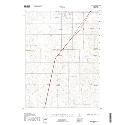
2018 Map of Lamoni South
USGS Topo · Published 2018About this map
Lamoni sits at the northern edge of this survey, where the street grid of the Iowa college town meets the rolling agricultural borderlands of Missouri. The landscape is defined by the branching drainage of the E Fork Big Cr, which carves through the terrain alongside numerous tributaries like Shain Cr and Zadie Cr. Local water features such as Founders Lake, Big G Lake, and Savely Lake dot the countryside, illustrating the managed hydrology of the region. The map preserves the locations of several community landmarks essential for genealogical research, including Rose Hill Cem in town, and the more remote Sweet Home Cem and Andover Cem. To the southeast, the small settlement of Andover serves as a rural anchor near the Decatur Co Harrison Co line, which also marks the state boundary between Iowa and Missouri.
Find a feature on this map
81 named features on this map. Tap any name to fly to it.
Don’t see what you’re looking for? This feature index may not catch every label — zoom into the map to look around manually.
Map Details
Editions of this 2018 Lamoni South Map
This is the sole edition of this map. No revisions or reprints were ever made.
Other maps of this area

1945 · Mount Ayr
USGS Topo · 1:62,500

1945 · Lamoni
USGS Topo · 1:62,500

1947 · Lamoni
USGS Topo · 1:62,500

1947 · Blythedale
USGS Topo · 1:62,500

1947 · Mount Ayr
USGS Topo · 1:62,500

1948 · Bethany
USGS Topo · 1:62,500

1954 · Centerville
USGS Topo · 1:250,000

1955 · Nebraska City
USGS Topo · 1:250,000

1957 · Nebraska City
USGS Topo · 1:250,000

1957 · Centerville
USGS Topo · 1:250,000