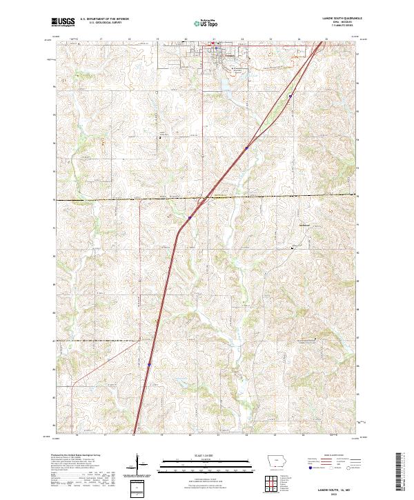
2022 Map of Lamoni South
USGS Topo · Published 2022About this map
Graceland University anchors the northern portion of this landscape, situated within the community of Lamoni. The town is characterized by a structured grid of streets including S State St and S Chestnut St, which transition into the agricultural sections of Decatur Co and across the Iowa Missouri state line. This borderland region is defined by the winding paths of several waterways, most notably the E Fork Big Cr, which carves through the undulating terrain alongside Shain Cr and Zadie Cr.
Find a feature on this map
81 named features on this map. Tap any name to fly to it.
Don’t see what you’re looking for? This feature index may not catch every label — zoom into the map to look around manually.
Map Details
Editions of this 2022 Lamoni South Map
This is the sole edition of this map. No revisions or reprints were ever made.
Other maps of this area

1945 · Mount Ayr
USGS Topo · 1:62,500

1945 · Lamoni
USGS Topo · 1:62,500

1947 · Lamoni
USGS Topo · 1:62,500

1947 · Blythedale
USGS Topo · 1:62,500

1947 · Mount Ayr
USGS Topo · 1:62,500

1948 · Bethany
USGS Topo · 1:62,500

1954 · Centerville
USGS Topo · 1:250,000

1955 · Nebraska City
USGS Topo · 1:250,000

1957 · Nebraska City
USGS Topo · 1:250,000

1957 · Centerville
USGS Topo · 1:250,000