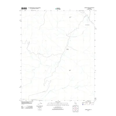
2012 Map of Lamont Peak
USGS Topo · Published 2012About this map
Chimney Peak and its namesake high-altitude meadow dominate this portion of Kern County, where the southern Sierra Nevada landscape begins its dramatic descent. The drainage of Chimney Cr winds through the center of the sheet, connecting Chimney Meadow to the lower Lamont Meadow. This 2012 survey illustrates the sparse, rugged character of the area, defined primarily by its watercourses and granite summits like Lamont Peak. The transportation network is limited to narrow access routes such as Chimney Basin Rd and 9 Mile Canyon Rd, which navigate the steep elevations. In the southern reach of the map, Canebrake Cr and Spanish Needle Cr create deep incisions in the terrain. The map serves as a clear record of this undeveloped wilderness, showing the relationship between seasonal meadows and the creek systems that sustain them.
Find a feature on this map
12 named features on this map. Tap any name to fly to it.
Don’t see what you’re looking for? This feature index may not catch every label — zoom into the map to look around manually.
Map Details
Editions of this 2012 Lamont Peak Map
This is the sole edition of this map. No revisions or reprints were ever made.
Other maps of this area

1906 · Kernville
USGS Topo · 1:125,000

1908 · Kernville
USGS Topo · 1:125,000

1915 · Searles Lake
USGS Topo · 1:250,000

1943 · Inyokern
USGS Topo · 1:62,500

1943 · Onyx
USGS Topo · 1:62,500

1947 · Trona
USGS Topo · 1:250,000

1948 · Trona
USGS Topo · 1:250,000

1948 · Bakersfield
USGS Topo · 1:250,000

1953 · Trona
USGS Topo · 1:250,000

1954 · Little Lake
USGS Topo · 1:62,500