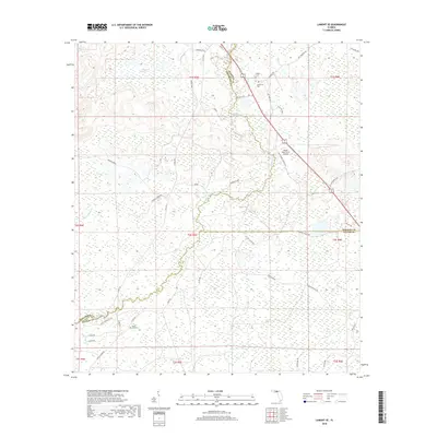
2018 Map of Lamont SE
USGS Topo · Published 2018About this map
The Aucilla River winds through this heavily forested and wetland-rich landscape at the junction of Jefferson, Madison, and Taylor Counties. This modern survey illustrates a region defined by its hydrology and rural history, where large tracts of swamp and timberland are punctuated by family-named landmarks and historical burial grounds. Small cemeteries such as Walker Cem, Henderson Cem, and the Powell Cemetery provide essential points of reference for genealogists tracing local lineages. The terrain rises slightly at Magnolia Hill in the north, while the southern reaches feature the residential character of Aucilla River Ests Rd. Evidence of local aviation and agriculture is found at the Mount Olive Farm Airport, reflecting the contemporary land use of this Florida panhandle interior. Water features like Lake Jackson and Anderson Bay dominate the northern wetlands, emphasizing the preservation of the area's natural drainage patterns.
Find a feature on this map
47 named features on this map. Tap any name to fly to it.
Don’t see what you’re looking for? This feature index may not catch every label — zoom into the map to look around manually.
Map Details
Editions of this 2018 Lamont SE Map
This is the sole edition of this map. No revisions or reprints were ever made.
Other maps of this area

1952 · Secotan
USGS Topo · 1:24,000

1954 · Johnson Hammock
USGS Topo · 1:24,000

1954 · Secotan
USGS Topo · 1:24,000

1954 · Greenville
USGS Topo · 1:24,000

1954 · Valdosta
USGS Topo · 1:250,000

1955 · Lamont
USGS Topo · 1:24,000

1955 · Waukeenah
USGS Topo · 1:24,000

1955 · Shady Grove
USGS Topo · 1:24,000

1955 · Nutall Rise
USGS Topo · 1:24,000

1955 · Lamont SE
USGS Topo · 1:24,000