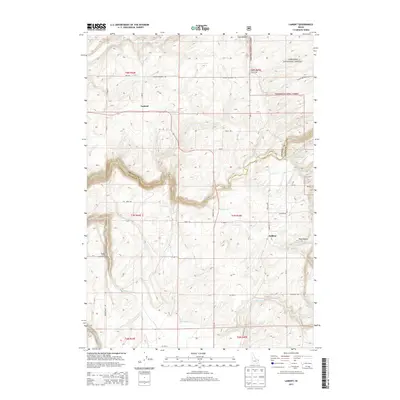
2013 Map of Lamont
USGS Topo · Published 2013About this map
Lamont stands as a central point of reference in this southeastern Idaho landscape, situated where the high plains meet the western slopes of the Teton Range. The boundary between Fremont and Teton Counties snakes through the center of the sheet, following the winding course of Bitch Creek. This deep canyon provides a sharp contrast to the surrounding agricultural grid, where roads like Neely Rd and Coyote Meadows Rd define the land's organization. To the east, the terrain rises into the Targhee National Forest, a transition marked by the isolated Bitch Creek Cow Camp and the topographic shifts of Pole Canyon.
Find a feature on this map
32 named features on this map. Tap any name to fly to it.
Don’t see what you’re looking for? This feature index may not catch every label — zoom into the map to look around manually.
Map Details
Editions of this 2013 Lamont Map
This is the sole edition of this map. No revisions or reprints were ever made.
Other maps of this area

1955 · Ashton
USGS Topo · 1:250,000

1955 · Driggs
USGS Topo · 1:250,000

1957 · Warm River Butte
USGS Topo · 1:62,500

1958 · Driggs
USGS Topo · 1:250,000

1958 · Ashton
USGS Topo · 1:250,000

1960 · Ashton
USGS Topo · 1:250,000

1962 · Driggs
USGS Topo · 1:250,000

1965 · Lamont
USGS Topo · 1:24,000

1965 · Packsaddle Lake
USGS Topo · 1:24,000

1965 · Mc Renolds Reservoir
USGS Topo · 1:24,000