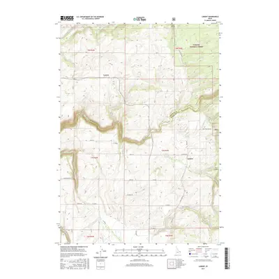
2017 Map of Lamont
USGS Topo · Published 2017About this map
The Teton River carves a deep, winding canyon through the center of this landscape, creating a distinct natural boundary that separates the agricultural plateaus of the west from the forested foothills of the east. In the early 21st century, the small community of Lamont serves as a central hub for the surrounding farmsteads, connected by a network of rural routes such as Neely Rd and Ricks Rd. To the east, the terrain rises into the Targhee National Forest, where features like Coyote Meadows and Cart Hollow mark a transition into more secluded mountain territory.
Find a feature on this map
34 named features on this map. Tap any name to fly to it.
Don’t see what you’re looking for? This feature index may not catch every label — zoom into the map to look around manually.
Map Details
Editions of this 2017 Lamont Map
This is the sole edition of this map. No revisions or reprints were ever made.
Other maps of this area

1955 · Ashton
USGS Topo · 1:250,000

1955 · Driggs
USGS Topo · 1:250,000

1957 · Warm River Butte
USGS Topo · 1:62,500

1958 · Driggs
USGS Topo · 1:250,000

1958 · Ashton
USGS Topo · 1:250,000

1960 · Ashton
USGS Topo · 1:250,000

1962 · Driggs
USGS Topo · 1:250,000

1965 · Lamont
USGS Topo · 1:24,000

1965 · Packsaddle Lake
USGS Topo · 1:24,000

1965 · Mc Renolds Reservoir
USGS Topo · 1:24,000