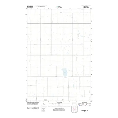
2011 Map of LaMoure SW
USGS Topo · Published 2011About this map
Cottonwood Lake and its surrounding wetlands define the landscape of this Dickey County prairie region, where the hydrology of the Great Plains is captured in detail. The map shows a strictly organized section-line road grid, including County Rd 62 and 72nd St SE, which facilitates the region's agricultural industry. This reliance on large-scale farming is evidenced by specialized private infrastructure like the Leiseth Farms Landing Strip and the Larson Landing Strip. Smaller ephemeral water features and the winding course of Cottonwood Creek punctuate the rectilinear fields, illustrating the persistent influence of natural drainage on North Dakota's managed agricultural lands in the early twenty-first century.
Find a feature on this map
21 named features on this map. Tap any name to fly to it.
Don’t see what you’re looking for? This feature index may not catch every label — zoom into the map to look around manually.
Map Details
Editions of this 2011 LaMoure SW Map
This is the sole edition of this map. No revisions or reprints were ever made.
Other maps of this area

1894 · Monango
USGS Topo · 1:62,500

1894 · La Moure
USGS Topo · 1:62,500

1894 · Fullerton
USGS Topo · 1:62,500

1895 · Lamoure
USGS Topo · 1:125,000

1896 · Edgeley
USGS Topo · 1:125,000

1918 · La Moure
USGS Topo · 1:125,000

1925 · Edgeley
USGS Topo · 1:125,000

1952 · Grand Rapids
USGS Topo · 1:24,000

1953 · Jamestown
USGS Topo · 1:250,000

1955 · Fullerton NE
USGS Topo · 1:24,000