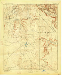
1894 Map of Lamy
USGS Topo · Published 1925About this map
The Atchison Topeka & Santa Fe railroad cuts a vital path through the high desert of northern New Mexico, serving as the primary artery for trade and travel. Near the northern edge, Lamy stands as a significant rail junction where the tracks navigate complex terrain before heading toward the southern plains. The landscape is defined by its dramatic drainage systems, including the Canyon Blanco and Canyon Venado, which carve deep paths through the mesas and rincóns. Small settlements and isolated ranchsteads like Galisteo and Gomez Ranch are positioned near seasonal water sources such as the Rito Galisteo and Arroyo San Cristobal. These pockets of habitation illustrate the late nineteenth-century reliance on precise geography for survival, with land use concentrated in the valleys between prominent landmarks like El Cuervo Butte and Cerro Pelon.
Find a feature on this map
44 named features on this map. Tap any name to fly to it.
Don’t see what you’re looking for? This feature index may not catch every label — zoom into the map to look around manually.
Map Details
Editions of this 1894 Lamy Map
5 editions found

Other maps of this area

1889 · Las Vegas
USGS Topo · 1:125,000

1889 · Santa Fe
USGS Topo · 1:125,000

1890 · Bernal
USGS Topo · 1:125,000

1891 · Bernal
USGS Topo · 1:125,000

1891 · Las Vegas
USGS Topo · 1:125,000

1892 · San Pedro
USGS Topo · 1:125,000

1892 · Santa Clara
USGS Topo · 1:125,000

1893 · Las Vegas
USGS Topo · 1:125,000

1894 · Santa Fe
USGS Topo · 1:125,000

1894 · Bernal
USGS Topo · 1:125,000