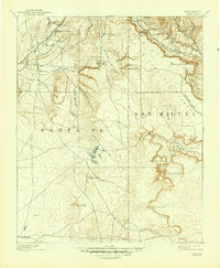
1894 Map of Lamy
USGS Topo · Published 1946About this map
Lamy serves as a critical railroad junction in this high-desert landscape, where the Atchison Topeka & Santa Fe snakes through the complex terrain of the Santa Fe National Forest. This 1890s reconnaissance survey, conducted by J.B. Lippincott and Jos. Jacobs, documents a transition from the rail-centered villages of Rowe and Fulton to the more dispersed ranching outposts like Gomez Ranch and the isolated Ranch further south.
Find a feature on this map
43 named features on this map. Tap any name to fly to it.
Don’t see what you’re looking for? This feature index may not catch every label — zoom into the map to look around manually.
Map Details
Editions of this 1894 Lamy Map
5 editions found

Other maps of this area

1889 · Las Vegas
USGS Topo · 1:125,000

1889 · Santa Fe
USGS Topo · 1:125,000

1890 · Bernal
USGS Topo · 1:125,000

1891 · Bernal
USGS Topo · 1:125,000

1891 · Las Vegas
USGS Topo · 1:125,000

1892 · San Pedro
USGS Topo · 1:125,000

1892 · Santa Clara
USGS Topo · 1:125,000

1893 · Las Vegas
USGS Topo · 1:125,000

1894 · Santa Fe
USGS Topo · 1:125,000

1894 · Bernal
USGS Topo · 1:125,000