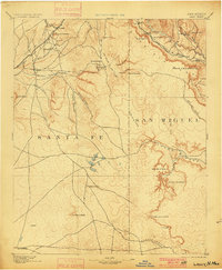
1894 Map of Lamy
USGS Topo · Published 1900About this map
Lamy and Galisteo anchor this high-desert landscape in the years before the turn of the century, illustrating a period of transition as the railroad redefined the western economy. The Atchison Topeka & Santa Fe RR cuts through the northern terrain, creating new rail stops like Fulton and Sands while bypassing older ranching outposts. The network of seasonal watercourses, such as Arroyo San Cristobal and Arroyo Jara, dictates the placement of early settlements and Ranch sites. This survey records a geography of scattered springs, or ojos, including Ojo de la Vaca and Ojo Hediondo, which were vital for survival in the arid high country of Santa Fe and San Miguel counties. Notable landforms like Cerro Colorado and the distinctive El Cuervo Butte serve as landmarks across the open range, while deep cuts like Canyon Blanco define the eastern edges of the map.
Find a feature on this map
40 named features on this map. Tap any name to fly to it.
Don’t see what you’re looking for? This feature index may not catch every label — zoom into the map to look around manually.
Map Details
Editions of this 1894 Lamy Map
5 editions found

Other maps of this area

1889 · Las Vegas
USGS Topo · 1:125,000

1889 · Santa Fe
USGS Topo · 1:125,000

1890 · Bernal
USGS Topo · 1:125,000

1891 · Bernal
USGS Topo · 1:125,000

1891 · Las Vegas
USGS Topo · 1:125,000

1892 · San Pedro
USGS Topo · 1:125,000

1892 · Santa Clara
USGS Topo · 1:125,000

1893 · Las Vegas
USGS Topo · 1:125,000

1894 · Santa Fe
USGS Topo · 1:125,000

1894 · Bernal
USGS Topo · 1:125,000