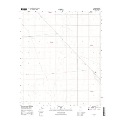
2017 Map of Lanark
USGS Topo · Published 2017About this map
Lanark and Vevay sit at the intersection of a vast desert landscape and a historic transportation corridor in southern New Mexico. This 2017 survey by the U.S. Geological Survey shows a sparsely populated region of Doña Ana County defined by long, straight desert roads and minimal water infrastructure. Settlement patterns are sparse, with the presence of Lanark Tank serving as a vital landmark in an arid environment otherwise dominated by township and range section lines. The map traces the diagonal path of Co Rd A-12 as it cuts across the landscape, linking these high-desert outposts. This specific record provides a clear view of the modern road network, including routes like Co Rd A011 and Co Rd A-14, which facilitate movement across the open terrain of the Mesilla Valley region.
Find a feature on this map
17 named features on this map. Tap any name to fly to it.
Don’t see what you’re looking for? This feature index may not catch every label — zoom into the map to look around manually.
Map Details
Editions of this 2017 Lanark Map
This is the sole edition of this map. No revisions or reprints were ever made.
Other maps of this area

1891 · Las Cruces
USGS Topo · 1:125,000

1893 · Las Cruces
USGS Topo · 1:125,000

1917 · Canutillo
USGS Topo · 1:62,500

1917 · Noria
USGS Topo · 1:62,500

1918 · Noria
USGS Topo · 1:62,500

1919 · Canutillo
USGS Topo · 1:62,500

1943 · La Mesa
USGS Topo · 1:62,500

1943 · Afton
USGS Topo · 1:62,500

1953 · El Paso
USGS Topo · 1:250,000
1955 · Strauss
USGS Topo · 1:24,000