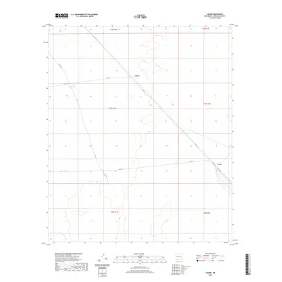
2020 Map of Lanark
USGS Topo · Published 2020About this map
Lanark sits at the center of this arid landscape in southern Doña Ana County, where the desert floor is defined by a sparse network of county roads and water infrastructure. The settlement is positioned along Co Rd A011, a route that cuts diagonally across the township grids of the Mesilla Valley hinterlands. To the southwest, Lanark Tank provides a necessary water source in an area otherwise marked by the open terrain of the Chihuahuan Desert. Further southeast, the small settlement of Veyay appears near the junction of Co Rd A-14 and Co Rd A-12, illustrating the modest development patterns of this borderland region. The map reflects a landscape organized by section lines and remote transit corridors, serving as a record of rural land use and the enduring presence of these isolated outposts.
Find a feature on this map
17 named features on this map. Tap any name to fly to it.
Don’t see what you’re looking for? This feature index may not catch every label — zoom into the map to look around manually.
Map Details
Editions of this 2020 Lanark Map
This is the sole edition of this map. No revisions or reprints were ever made.
Other maps of this area

1891 · Las Cruces
USGS Topo · 1:125,000

1893 · Las Cruces
USGS Topo · 1:125,000

1917 · Canutillo
USGS Topo · 1:62,500

1917 · Noria
USGS Topo · 1:62,500

1918 · Noria
USGS Topo · 1:62,500

1919 · Canutillo
USGS Topo · 1:62,500

1943 · La Mesa
USGS Topo · 1:62,500

1943 · Afton
USGS Topo · 1:62,500

1953 · El Paso
USGS Topo · 1:250,000
1955 · Strauss
USGS Topo · 1:24,000