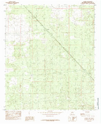
1985 Map of Lanark
USGS Topo · Published 1985About this map
Southern Pacific railroad tracks form the primary infrastructure of this Chihuahuan Desert landscape, cutting a straight diagonal from the northwest to the southeast. Along this industrial corridor, the map records the small settlement of Lanark and the location of Vevay, both situated to serve the rail line in this arid region of Doña Ana County. Water management for steam-era or maintenance needs is evidenced by the presence of Lanark Tank, located just west of the main cluster of buildings at Lanark. The terrain is characterized by subtle contour changes and sandy basins, where the absence of dense development highlights how critical the railroad was to the connectivity and survival of these outposts in the late twentieth century.
Find a feature on this map
4 named features on this map. Tap any name to fly to it.
Don’t see what you’re looking for? This feature index may not catch every label — zoom into the map to look around manually.
Map Details
Editions of this 1985 Lanark Map
This is the sole edition of this map. No revisions or reprints were ever made.
Other maps of this area

1891 · Las Cruces
USGS Topo · 1:125,000

1893 · Las Cruces
USGS Topo · 1:125,000

1917 · Canutillo
USGS Topo · 1:62,500

1917 · Noria
USGS Topo · 1:62,500

1918 · Noria
USGS Topo · 1:62,500

1919 · Canutillo
USGS Topo · 1:62,500

1943 · La Mesa
USGS Topo · 1:62,500

1943 · Afton
USGS Topo · 1:62,500

1953 · El Paso
USGS Topo · 1:250,000
1955 · Strauss
USGS Topo · 1:24,000