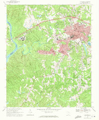
1969 Map of Lancaster
USGS Topo · Published 1971About this map
The Lancaster textile and manufacturing corridor comes into focus in this late 1960s study, defined by the industrial infrastructure of the Lancaster and Chester railroad and the Southern line. The urban core shows significant civic development, including the Courthouse, Univ of South Carolina Extension College, and numerous neighborhood institutions like North Jr High Sch and Barr Street Sch. This era captures the expansion of suburban-style residential footprints into formerly rural areas, though the landscape remains anchored by long-standing community markers such as White Springs Ch and Crocketts Crossroads.
Find a feature on this map
65 named features on this map. Tap any name to fly to it.
Don’t see what you’re looking for? This feature index may not catch every label — zoom into the map to look around manually.
Map Details
Editions of this 1969 Lancaster Map
3 editions found
Other maps of this area

1941 · Spartanburg
USGS Topo · 1:250,000

1953 · Spartanburg
USGS Topo · 1:250,000

1960 · Spartanburg
USGS Topo · 1:250,000

1963 · Spartanburg
USGS Topo · 1:250,000

1964 · Spartanburg
USGS Topo · 1:250,000

1968 · Van Wyck
USGS Topo · 1:24,000

1968 · Catawba
USGS Topo · 1:24,000

1968 · Lancaster SE
USGS Topo · 1:24,000

1968 · Heath Springs
USGS Topo · 1:24,000

1969 · Antioch
USGS Topo · 1:24,000