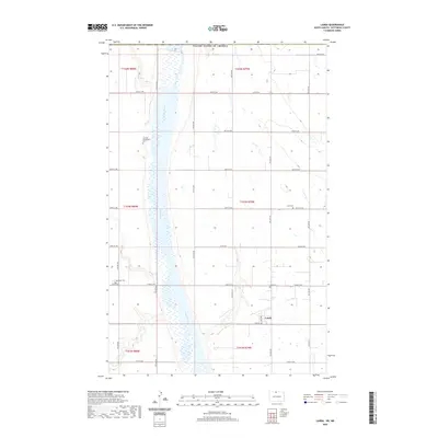
2020 Map of Landa
USGS Topo · Published 2020About this map
The Souris River cuts a wide, marshy path through the center of this Bottineau County landscape, defining the rural character of the region. On the eastern bank, the small settlement of Landa sits at the junction of Main Ave and 102nd St NW, serving as a focal point for the surrounding agricultural sections. The map reveals a dense network of section-line roads, such as Co Rd 27A and 107th St NW, which segment the prairie into a precise grid.
Find a feature on this map
31 named features on this map. Tap any name to fly to it.
Don’t see what you’re looking for? This feature index may not catch every label — zoom into the map to look around manually.
Map Details
Editions of this 2020 Landa Map
This is the sole edition of this map. No revisions or reprints were ever made.
Other maps of this area

1949 · Landa
USGS Topo · 1:24,000

1949 · Landa SW
USGS Topo · 1:24,000

1950 · Landa
USGS Topo · 1:24,000

1950 · Landa SW
USGS Topo · 1:24,000

1951 · Westhope SE
USGS Topo · 1:24,000
1951 · Westhope
USGS Topo · 1:24,000

1954 · Landa SE
USGS Topo · 1:24,000

1954 · Roth
USGS Topo · 1:24,000

1954 · Minot
USGS Topo · 1:250,000

1958 · Minot
USGS Topo · 1:250,000