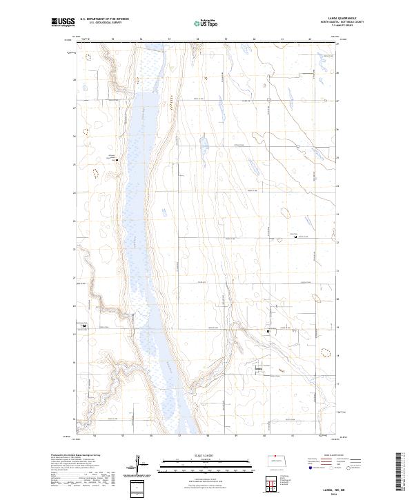
2024 Map of Landa
USGS Topo · Published 2024About this map
Landa and the surrounding plains of Bottineau County are defined by the meandering course of the Souris River. This prairie landscape is significantly shaped by the J. Clark Salyer National Wildlife Refuge, which protects the river's wetlands as they snake through the township lines of t163n r79w and t164n r80w. The settlement pattern is typical of North Dakota's rural grid, punctuated by small community landmarks that reflect the area's pioneer heritage. Genealogists and local historians will find several key burial sites preserved here, including the Acheson Homestead Cem, Zion Cem, and Nesthope Cem. These small cemeteries, along with the Landa Cem near the town site, serve as the primary physical markers of the families who settled this northern reach of the Souris Basin.
Find a feature on this map
30 named features on this map. Tap any name to fly to it.
Don’t see what you’re looking for? This feature index may not catch every label — zoom into the map to look around manually.
Map Details
Editions of this 2024 Landa Map
This is the sole edition of this map. No revisions or reprints were ever made.
Other maps of this area

1949 · Landa
USGS Topo · 1:24,000

1949 · Landa SW
USGS Topo · 1:24,000

1950 · Landa
USGS Topo · 1:24,000

1950 · Landa SW
USGS Topo · 1:24,000

1951 · Westhope SE
USGS Topo · 1:24,000
1951 · Westhope
USGS Topo · 1:24,000

1954 · Landa SE
USGS Topo · 1:24,000

1954 · Roth
USGS Topo · 1:24,000

1954 · Minot
USGS Topo · 1:250,000

1958 · Minot
USGS Topo · 1:250,000