
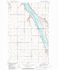
1949 Map of Landa SW
USGS Topo · Published 1966About this map
The Lower Souris National Wildlife Refuge dominates this northern Bottineau County landscape, following the winding course of the Souris River through the heart of the prairie. Established during the New Deal era, the refuge complex shown here reveals the intricate system of pools and spillways designed to manage water levels for migratory waterfowl. Surrounding the river valley, the upland townships of Sergius, Eidsvold, Starbuck, Kane, and Brandon are organized in a strict section grid, reflecting the late 1940s agricultural pattern of the Red River Valley’s western reaches.
Find a feature on this map
13 named features on this map. Tap any name to fly to it.
Don’t see what you’re looking for? This feature index may not catch every label — zoom into the map to look around manually.
Map Details
Editions of this 1949 Landa SW Map
2 editions found
Other maps of this area

1949 · Eckman
USGS Topo · 1:24,000

1949 · Landa
USGS Topo · 1:24,000

1950 · Newburg
USGS Topo · 1:24,000

1950 · Deep
USGS Topo · 1:24,000

1950 · Landa
USGS Topo · 1:24,000

1950 · Landa SW
USGS Topo · 1:24,000

1951 · Westhope SE
USGS Topo · 1:24,000
1951 · Westhope
USGS Topo · 1:24,000

1954 · Landa SE
USGS Topo · 1:24,000

1954 · Roth
USGS Topo · 1:24,000