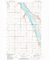
1949 Map of Landa SW
USGS Topo · Published 1980About this map
The Souris River carves a significant corridor through this Bottineau County landscape, where water management is defined by structures like Spillway Elev 1416. This mid-century survey, based on 1940s fieldwork with 1980 updates, details the J Clark Salyer National Wildlife Refuge as it occupies the river valley. The surrounding prairie is organized into distinct rural townships including Sergius, Eidsvold, Starbuck, and Brander. Small-scale local infrastructure is visible through the placement of School No 2 and School No 3, marking the centers of these farming communities. The topography is relatively flat, typical of the North Dakota plains, punctuated only by a small Gravel Pit and the gentle descent toward the river bottomlands.
Find a feature on this map
14 named features on this map. Tap any name to fly to it.
Don’t see what you’re looking for? This feature index may not catch every label — zoom into the map to look around manually.
Map Details
Editions of this 1949 Landa SW Map
2 editions found
Other maps of this area

1949 · Eckman
USGS Topo · 1:24,000

1949 · Landa
USGS Topo · 1:24,000

1949 · Landa SW
USGS Topo · 1:24,000

1950 · Newburg
USGS Topo · 1:24,000

1950 · Deep
USGS Topo · 1:24,000

1950 · Landa
USGS Topo · 1:24,000

1950 · Landa SW
USGS Topo · 1:24,000

1951 · Westhope SE
USGS Topo · 1:24,000
1951 · Westhope
USGS Topo · 1:24,000

1954 · Landa SE
USGS Topo · 1:24,000