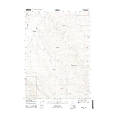
2015 Map of Lander SE
USGS Topo · Published 2015About this map
The Little Popo Agie River meanders through the northwest corner of this Fremont County landscape, supporting a network of historic irrigation systems including Lyons Ditch, Wise Ditch, and Millard Ditch. These watercourses emphasize the region's agricultural reliance on redirected river flows within an otherwise arid, high-desert environment. The terrain is defined by a series of named drainages that highlight the area's geological and industrial history, such as Coal Mine Draw and Coal Mine Gulch, which point to early mineral extraction efforts. High points like Monument Butte and the elevation of Blue Ridge provide significant landmarks overlooking the complex network of draws, including Hudson Draw and Ballenger Draw. The map details the local infrastructure through roads like Lyons Valley Rd and Coalmine Rd, tracing the paths carved by ranching and resource development in central Wyoming.
Find a feature on this map
26 named features on this map. Tap any name to fly to it.
Don’t see what you’re looking for? This feature index may not catch every label — zoom into the map to look around manually.
Map Details
Editions of this 2015 Lander SE Map
This is the sole edition of this map. No revisions or reprints were ever made.
Other maps of this area

1952 · Hudson
USGS Topo · 1:24,000

1952 · Lander SE
USGS Topo · 1:24,000

1952 · Lander
USGS Topo · 1:24,000

1952 · Lander NW
USGS Topo · 1:24,000

1953 · Ninemile Hill
USGS Topo · 1:24,000

1953 · Arapahoe
USGS Topo · 1:24,000

1953 · Del Monte Ridge
USGS Topo · 1:24,000

1953 · Weiser Pass
USGS Topo · 1:24,000

1954 · Wolf Point
USGS Topo · 1:24,000

1955 · Lander
USGS Topo · 1:250,000