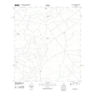
2010 Map of Landrum Tank
USGS Topo · Published 2010About this map
Briscoes Catarina Ranch Airport and a series of managed water resources define this ranching landscape in Webb County during the early 21st century. The map reveals a complex system of livestock infrastructure and water management, centered on the Espejo Ranch and Brown Ranch properties. Significant engineering is evident through numerous named impoundments such as the Dolph Briscoe Lake Number 7 Dam, Dolph Briscoe Lake Number 6 Dam, and Gates Lake Dam, which capture seasonal flows from drainage systems like Bonito Creek and the Espejo watercourse. The network of rural routes, including FM 2688 and RD 5004, provides the primary access through this sparse, industrial ranching terrain, illustrating how modern land use in South Texas adapts to a semi-arid environment through extensive water catchment and private aviation.
Find a feature on this map
12 named features on this map. Tap any name to fly to it.
Don’t see what you’re looking for? This feature index may not catch every label — zoom into the map to look around manually.
Map Details
Editions of this 2010 Landrum Tank Map
This is the sole edition of this map. No revisions or reprints were ever made.
Other maps of this area

1929 · Cotulla
USGS Topo · 1:125,000

1932 · Valley Wells
USGS Topo · 1:62,500

1940 · Asherton
USGS Topo · 1:62,500

1940 · Velenzuela Creek
USGS Topo · 1:62,500

1940 · San Loranzo Creek
USGS Topo · 1:62,500

1940 · Catarina
USGS Topo · 1:62,500

1953 · Crystal City
USGS Topo · 1:250,000

1955 · Crystal City
USGS Topo · 1:250,000

1961 · Crystal City
USGS Topo · 1:250,000

1968 · Crystal City
USGS Topo · 1:250,000