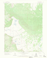
1962 Map of Lands End
USGS Topo · Published 1971About this map
Grand Mesa National Forest dominates this 1960s landscape, showcasing a complex hydraulic network of reservoirs and creeks high atop the mesa. The prominence of water management is evident through numerous named catchments like Bolen Reservoir, the Palisade Res No 3, and the multi-named Bolen, Anderson, and Jacobs Reservoir No. 2. This high-altitude plateau, characterized by the dramatic West Bench and Whitewater Basin, was a critical infrastructure hub for the surrounding region, hosting an Airway Beacon and Radio Towers near Rapid Creek Res No 1. Public recreation and access are clearly defined along the winding Lands End Road, which leads visitors to the Lands End Overlook Picnic Ground and scenic points like Crater View. The presence of the Godding Grade suggests earlier logging or industrial routes integrated into the forest's development.
Find a feature on this map
45 named features on this map. Tap any name to fly to it.
Don’t see what you’re looking for? This feature index may not catch every label — zoom into the map to look around manually.
Map Details
Editions of this 1962 Lands End Map
4 editions found
Other maps of this area

1955 · Cameo
USGS Topo · 1:24,000

1955 · Mesa
USGS Topo · 1:24,000

1955 · Molina
USGS Topo · 1:24,000

1955 · Skyway
USGS Topo · 1:24,000

1956 · Moab
USGS Topo · 1:250,000

1956 · Grand Junction
USGS Topo · 1:250,000

1959 · Grand Junction
USGS Topo · 1:250,000

1959 · Moab
USGS Topo · 1:250,000

1960 · Moab
USGS Topo · 1:250,000

1960 · Grand Junction
USGS Topo · 1:250,000