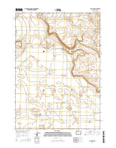
2014 Map of Lane Lake
USGS Topo · Published 2014About this map
The high desert landscape of the Fort Rock Valley is captured in this 2014 survey, highlighting a region defined by its distinct volcanic and hydrologic features. The ephemeral Lane Lake and the Stingley Reservoir serve as primary water markers in an otherwise arid expanse. Topographic landmarks like Flatiron and the route along Green Mtn illustrate the elevation shifts typical of Lake County's northern reaches. A sparse but intentional grid of access roads, including Salt Flat Ln, Candlestick Rd, and Emanuel Way, indicates the enduring utility of this land for ranching or resource management. Researchers can find several wells, such as Bowman Wls and Gerkins Wls, which point to the vital subsurface water infrastructure necessary for sustaining activity in this part of Oregon.
Find a feature on this map
24 named features on this map. Tap any name to fly to it.
Don’t see what you’re looking for? This feature index may not catch every label — zoom into the map to look around manually.
Map Details
Editions of this 2014 Lane Lake Map
This is the sole edition of this map. No revisions or reprints were ever made.
Other maps of this area

1955 · Crescent
USGS Topo · 1:250,000

1957 · Crescent
USGS Topo · 1:250,000

1958 · Crescent
USGS Topo · 1:250,000

1970 · Crescent
USGS Topo · 1:250,000

1981 · Hogback Butte
USGS Topo · 1:24,000

1981 · Cougar Mtn
USGS Topo · 1:24,000

1981 · Thorn Lake
USGS Topo · 1:24,000

1981 · Lane Lake
USGS Topo · 1:24,000
1981 · Tuff Butte
USGS Topo · 1:24,000
1982 · Schaub Lake
USGS Topo · 1:24,000