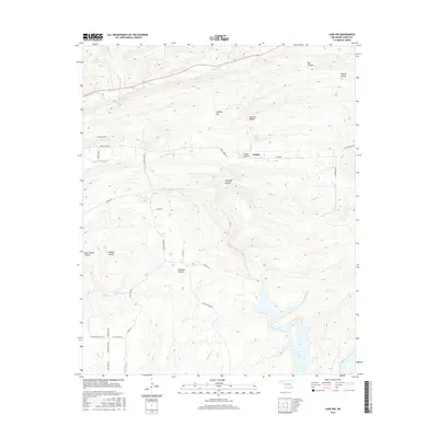
2016 Map of Lane NW
USGS Topo · Published 2016About this map
The Fugate settlement and its surrounding landscape in Atoka County reveal a terrain defined by named hollows and expansive prairies in the mid-2010s. The topography is deeply incised by a dense network of drainages, including Chickasaw Cr and Little Chickasaw Cr to the north, and August Cr and Cabin Cr to the south. Land use in this portion of Oklahoma is marked by distinct open areas like Hiawana Prairie and West Windy Prairie, contrasting with the more secluded, family-named lowlands such as Kennedy Hollow and Peacock Hollow. The road network, featuring names like Cane Break Rd and Greasy Bend Rd, follows the natural ridges and valleys between these watercourses. This survey also records Atoka County Lake, a significant water feature fed by Potapo Cr, situated just north of the Fugate community.
Find a feature on this map
38 named features on this map. Tap any name to fly to it.
Don’t see what you’re looking for? This feature index may not catch every label — zoom into the map to look around manually.
Map Details
Editions of this 2016 Lane NW Map
This is the sole edition of this map. No revisions or reprints were ever made.
Other maps of this area

1896 · Coalgate
USGS Topo · 1:125,000

1898 · McAlester
USGS Topo · 1:125,000

1899 · Coalgate
USGS Topo · 1:125,000

1899 · Atoka
USGS Topo · 1:125,000

1900 · Atoka
USGS Topo · 1:125,000

1900 · Coalgate
USGS Topo · 1:125,000

1901 · Antlers
USGS Topo · 1:125,000

1909 · Mc Alester
USGS Topo · 1:125,000

1912 · Antlers
USGS Topo · 1:125,000

1925 · Antlers
USGS Topo · 1:125,000