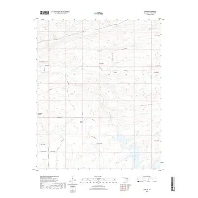
2019 Map of Lane NW
USGS Topo · Published 2019About this map
The settlement of Fugate sits at the center of this landscape in Atoka County, where the terrain transitions from prairie to deeply etched hollows. The southeastern corner is dominated by the waters of the McGee Creek Reservoir, fed by Panther Cr and Potapo Creek. This 2019 survey illustrates the intricate drainage patterns of the region, where numerous small waterways like Chickasaw Cr and Little Chickasaw Cr have carved out named landforms such as Ray Hollow and Peacock Hollow.
Find a feature on this map
47 named features on this map. Tap any name to fly to it.
Don’t see what you’re looking for? This feature index may not catch every label — zoom into the map to look around manually.
Map Details
Editions of this 2019 Lane NW Map
This is the sole edition of this map. No revisions or reprints were ever made.
Other maps of this area

1896 · Coalgate
USGS Topo · 1:125,000

1898 · McAlester
USGS Topo · 1:125,000

1899 · Coalgate
USGS Topo · 1:125,000

1899 · Atoka
USGS Topo · 1:125,000

1900 · Atoka
USGS Topo · 1:125,000

1900 · Coalgate
USGS Topo · 1:125,000

1901 · Antlers
USGS Topo · 1:125,000

1909 · Mc Alester
USGS Topo · 1:125,000

1912 · Antlers
USGS Topo · 1:125,000

1925 · Antlers
USGS Topo · 1:125,000