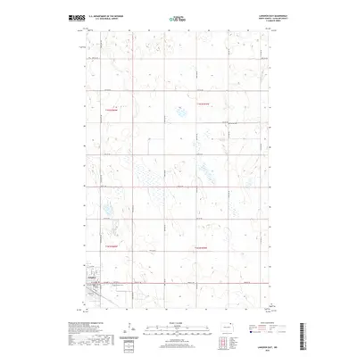
2020 Map of Langdon East
USGS Topo · Published 2020About this map
Langdon serves as the focal point of this northeastern North Dakota landscape, situated in the southwest corner of the quadrangle. As the seat of local government, it is anchored by the Cavalier County Court House, surrounded by a regular grid of streets including Hickory St and 8th Ave. The surrounding terrain transitions quickly into the expansive agricultural sections typical of the Red River Valley hinterlands, defined by a rigid network of section-line roads such as 106th Ave NE and 93rd St NE. Genealogists will find interest in the documented locations of Lebanon Cem just east of the town center and the more isolated Harvey Cem to the northeast. The map illustrates a landscape of prairie potholes and wetlands scattered across the township boundaries of t162n r59w and t161n r60w, highlighting the natural hydrology that persists amidst the cultivated fields.
Find a feature on this map
28 named features on this map. Tap any name to fly to it.
Don’t see what you’re looking for? This feature index may not catch every label — zoom into the map to look around manually.
Map Details
Editions of this 2020 Langdon East Map
This is the sole edition of this map. No revisions or reprints were ever made.
Other maps of this area

1953 · Devils Lake
USGS Topo · 1:250,000

1956 · Devils Lake
USGS Topo · 1:250,000

1967 · Langdon East
USGS Topo · 1:24,000

1967 · Maida
USGS Topo · 1:24,000

1969 · Olga SW
USGS Topo · 1:24,000

1969 · Olga NW
USGS Topo · 1:24,000

1970 · Mount Carmel
USGS Topo · 1:24,000

1970 · Langdon West
USGS Topo · 1:24,000

1972 · Osnabrock
USGS Topo · 1:24,000

1972 · Easby
USGS Topo · 1:24,000