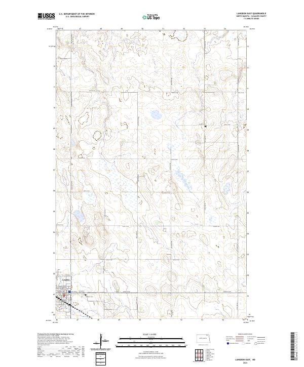
2024 Map of Langdon East
USGS Topo · Published 2024About this map
Langdon serves as the focal point of this northeastern North Dakota landscape, situated in the southwest corner where the grid of city streets like 4th Ave and Hickory St meets the open prairie. As the county seat, it houses the Cavalier County Court House, a significant landmark for local history and administration. The surrounding terrain is defined by a dense network of sectional roads and glacial depressions, many of which are protected within the Cavalier County Waterfowl Production Area. For genealogists and researchers, the map identifies small, remote burial sites including Harvey Cem to the northeast and Lebanon Cem just east of the town limits. The layout of the township lines, such as t162n r59w, illustrates the enduring structure of the Public Land Survey System across this agricultural region.
Find a feature on this map
39 named features on this map. Tap any name to fly to it.
Don’t see what you’re looking for? This feature index may not catch every label — zoom into the map to look around manually.
Map Details
Editions of this 2024 Langdon East Map
This is the sole edition of this map. No revisions or reprints were ever made.
Other maps of this area

1953 · Devils Lake
USGS Topo · 1:250,000

1956 · Devils Lake
USGS Topo · 1:250,000

1967 · Langdon East
USGS Topo · 1:24,000

1967 · Maida
USGS Topo · 1:24,000

1969 · Olga SW
USGS Topo · 1:24,000

1969 · Olga NW
USGS Topo · 1:24,000

1970 · Mount Carmel
USGS Topo · 1:24,000

1970 · Langdon West
USGS Topo · 1:24,000

1972 · Osnabrock
USGS Topo · 1:24,000

1972 · Easby
USGS Topo · 1:24,000