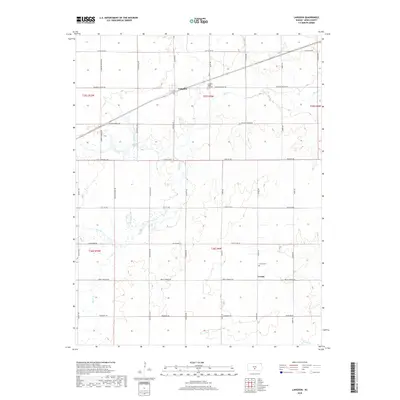
2018 Map of Langdon
USGS Topo · Published 2018About this map
The town of Langdon serves as the primary hub in this central Kansas agricultural landscape, situated along a prominent rail line that cuts diagonally across the northern townships. The area is defined by a grid of rural section roads such as Castleton Rd and Pretty Prairie Rd, which frame the farmsteads and fields of Reno County. These straight-line roads are only interrupted by the meandering paths of Silver Cr and Wolf Cr, which provide drainage and narrow corridors of varied terrain through the plains.
Find a feature on this map
29 named features on this map. Tap any name to fly to it.
Don’t see what you’re looking for? This feature index may not catch every label — zoom into the map to look around manually.
Map Details
Editions of this 2018 Langdon Map
This is the sole edition of this map. No revisions or reprints were ever made.
Other maps of this area

1892 · Kingman
USGS Topo · 1:125,000

1894 · Kingman
USGS Topo · 1:125,000

1955 · Pratt
USGS Topo · 1:250,000

1959 · Pratt
USGS Topo · 1:250,000

1966 · Cunningham
USGS Topo · 1:24,000

1967 · Kingman NW
USGS Topo · 1:24,000

1967 · Penalosa
USGS Topo · 1:24,000
1971 · Turon
USGS Topo · 1:24,000
1971 · Sylvia
USGS Topo · 1:24,000
1971 · Pretty Prairie SW
USGS Topo · 1:24,000