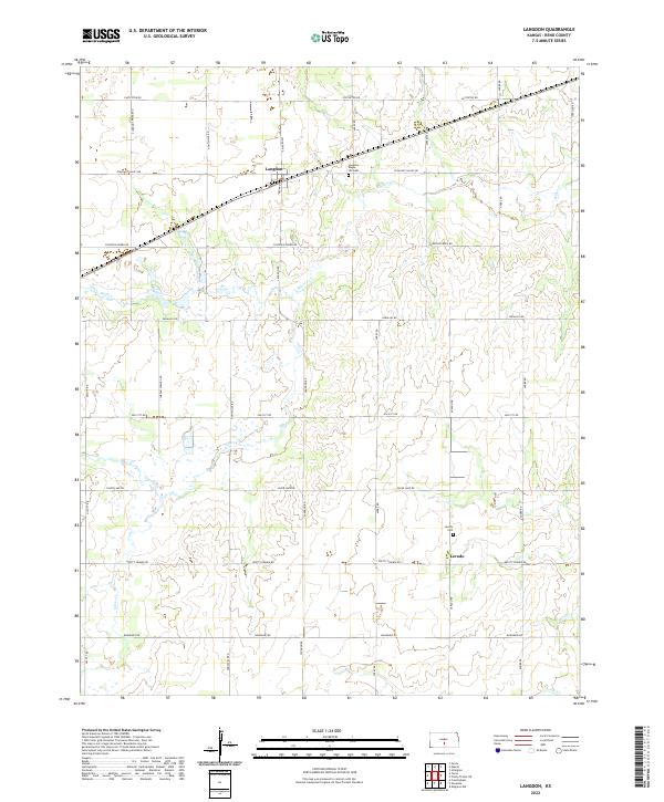
2022 Map of Langdon
USGS Topo · Published 2022About this map
Langdon and Lerado anchor this section of south-central Kansas, where the landscape is defined by the steady, angular grid of section roads and the winding paths of several prairie streams. The township is drained by the meanders of Silver Cr and Wolf Cr, which break the geometric precision of the agricultural layout. In the northern reaches, Langdon Maple Hill Cem sits just east of the main settlement near Pleasant Valley Rd, serving as a silent record of the area's generational residency.
Find a feature on this map
30 named features on this map. Tap any name to fly to it.
Don’t see what you’re looking for? This feature index may not catch every label — zoom into the map to look around manually.
Map Details
Editions of this 2022 Langdon Map
This is the sole edition of this map. No revisions or reprints were ever made.
Other maps of this area

1892 · Kingman
USGS Topo · 1:125,000

1894 · Kingman
USGS Topo · 1:125,000

1955 · Pratt
USGS Topo · 1:250,000

1959 · Pratt
USGS Topo · 1:250,000

1966 · Cunningham
USGS Topo · 1:24,000

1967 · Kingman NW
USGS Topo · 1:24,000

1967 · Penalosa
USGS Topo · 1:24,000
1971 · Turon
USGS Topo · 1:24,000
1971 · Sylvia
USGS Topo · 1:24,000
1971 · Pretty Prairie SW
USGS Topo · 1:24,000