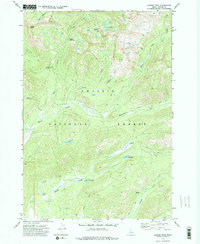
1972 Map of Langer Peak
USGS Topo · Published 1975About this map
Challis National Forest encompasses this high-elevation Idaho backcountry, where natural water features and early industrial attempts define the landscape. The topographic survey of the early 1970s reveals a complex network of glacial basins and high ridges, anchored by Langer Peak and the unique formation of the Langer Monument. Water is abundant throughout the quadrangle, from the clustered Vanity Lakes near Vanity Summit to the isolated Elk Lake and the cryptically named F 82 Lake.
Find a feature on this map
26 named features on this map. Tap any name to fly to it.
Don’t see what you’re looking for? This feature index may not catch every label — zoom into the map to look around manually.
Map Details
Editions of this 1972 Langer Peak Map
2 editions found
Other maps of this area

1891 · Bear Valley
USGS Topo · 1:125,000

1893 · Bear Valley
USGS Topo · 1:125,000

1919 · Custer
USGS Topo · 1:125,000

1922 · Custer
USGS Topo · 1:125,000

1930 · Casto
USGS Topo · 1:125,000

1957 · Challis
USGS Topo · 1:250,000

1960 · Challis
USGS Topo · 1:250,000

1961 · Greyhound Ridge
USGS Topo · 1:62,500

1963 · Challis
USGS Topo · 1:250,000

1963 · Pinyon Peak
USGS Topo · 1:24,000