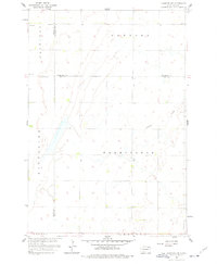
1958 Map of Langford SW
USGS Topo · Published 1977About this map
Farmington and Riverside townships define this mid-century prairie landscape, captured during a period of agricultural stability in the Missouri River Basin. The terrain is marked by the winding course of Antelope Creek and a network of section-line roads that organize the rural landscape. This survey, completed as part of a larger Department of the Interior program, provides a high-resolution view of the area's civil structure, including the local Town Hall and the Augustana Cem. Small depressions and wetland features are scattered throughout the townships of Claremont and Groton, illustrating the natural drainage patterns of Day County before modern land alterations. The intersection of Marshall, Brown, and Day counties creates a unique tri-county corner on this map, documenting the precise political boundaries of the 1950s.
Find a feature on this map
12 named features on this map. Tap any name to fly to it.
Don’t see what you’re looking for? This feature index may not catch every label — zoom into the map to look around manually.
Map Details
Editions of this 1958 Langford SW Map
2 editions found
Other maps of this area

1895 · Aberdeen
USGS Topo · 1:125,000

1896 · Columbia
USGS Topo · 1:125,000

1952 · Huffton
USGS Topo · 1:24,000

1953 · Milbank
USGS Topo · 1:250,000

1954 · Groton
USGS Topo · 1:24,000

1954 · Aberdeen
USGS Topo · 1:250,000

1956 · Aberdeen
USGS Topo · 1:250,000
1956 · Claremont
USGS Topo · 1:24,000

1958 · Milbank
USGS Topo · 1:250,000

1958 · Spain
USGS Topo · 1:24,000