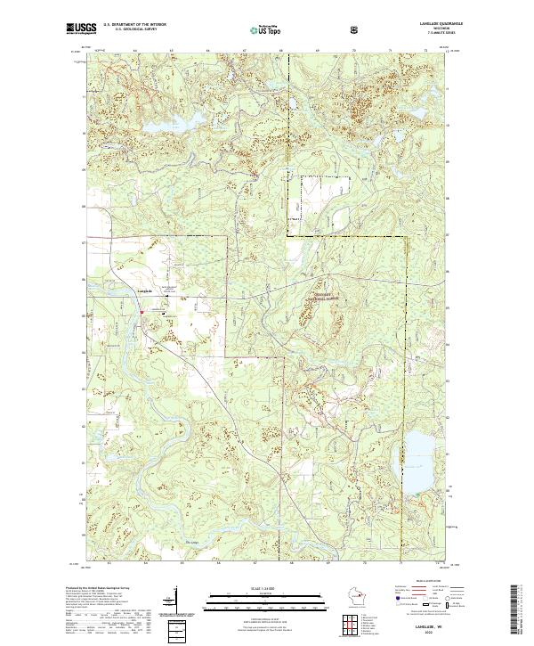
2022 Map of Langlade
USGS Topo · Published 2022About this map
The settlement of Langlade serves as a small hub in this landscape defined by the winding course of the Wolf River and the extensive wooded reaches of the Nicolet National Forest. Genealogists will find interest in the proximity of Saint Stanislaus Catholic Church Cem and the Langlade Cem, located near the junction of several local routes. The river itself is a primary feature, punctuated by numerous named white-water sections such as Crouse Rapids, Horse Race Rapids, and Garfield Rapids, illustrating the river's descent through the Northwoods. Beyond the river, the map details a dense network of glacial lakes including Rose Lake, Boulder Lake, and Wichser Lake. This 2022 survey also documents contemporary recreational infrastructure, showing the Wolf River State Trl and the Boulder Lake Mtb Trl, which navigate the varying elevations near The Ledge.
Find a feature on this map
54 named features on this map. Tap any name to fly to it.
Don’t see what you’re looking for? This feature index may not catch every label — zoom into the map to look around manually.
Map Details
Editions of this 2022 Langlade Map
This is the sole edition of this map. No revisions or reprints were ever made.
Other maps of this area

1942 · Wabeno
USGS Topo · 1:48,000

1942 · Pearson
USGS Topo · 1:48,000

1950 · Wabeno
USGS Topo · 1:48,000

1950 · Lily
USGS Topo · 1:48,000

1951 · Wabeno
USGS Topo · 1:48,000

1952 · White Lake
USGS Topo · 1:48,000

1952 · Langlade
USGS Topo · 1:48,000

1954 · Iron Mountain
USGS Topo · 1:250,000

1959 · Iron Mountain
USGS Topo · 1:250,000
1972 · Townsend
USGS Topo · 1:24,000