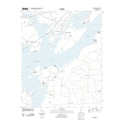
2011 Map of Langston
USGS Topo · Published 2011About this map
Guntersville Lake dominates this Jackson County landscape, its irregular shoreline creating numerous coves and peninsulas that have driven 21st-century residential growth. The settlement of Langston sits atop the high ground above Langston Gap, surrounded by several residential developments including Jackson Subdivision and Carver Subdivision. To the north, the Tennessee River course is marked by significant features like Goose Pond Island and Caldwell Bar, while the western edge is defined by the steep elevation of Pine Mountain and Backbone Ridge.
Find a feature on this map
119 named features on this map. Tap any name to fly to it.
Don’t see what you’re looking for? This feature index may not catch every label — zoom into the map to look around manually.
Map Details
Editions of this 2011 Langston Map
This is the sole edition of this map. No revisions or reprints were ever made.
Other maps of this area

1885 · Gadsden
USGS Topo · 1:125,000

1886 · Stevenson
USGS Topo · 1:125,000

1888 · Gadsden
USGS Topo · 1:125,000

1888 · Scottsboro
USGS Topo · 1:125,000

1892 · Scottsboro
USGS Topo · 1:125,000

1892 · Stevenson
USGS Topo · 1:125,000

1892 · Gadsden
USGS Topo · 1:125,000

1893 · Fort Payne
USGS Topo · 1:125,000

1895 · Stevenson
USGS Topo · 1:125,000

1895 · Gadsden
USGS Topo · 1:125,000