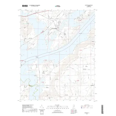
2018 Map of Langston
USGS Topo · Published 2018About this map
Guntersville Lake dominates the central landscape of this Jackson County survey, where the Tennessee River's waters wrap around Goose Pond Island and several prominent river bars. The terrain transitions sharply from the low-lying reaches of Caldwell Bar and North Sauty Creek Bar to the high elevations of Sand Mountain and Gunters Mtn. These ridges are cut by geographic notches like Langston Gap and Sublett Gap Hollow, which historically dictated the movement of goods and people between the valley and the uplands.
Find a feature on this map
129 named features on this map. Tap any name to fly to it.
Don’t see what you’re looking for? This feature index may not catch every label — zoom into the map to look around manually.
Map Details
Editions of this 2018 Langston Map
This is the sole edition of this map. No revisions or reprints were ever made.
Other maps of this area

1885 · Gadsden
USGS Topo · 1:125,000

1886 · Stevenson
USGS Topo · 1:125,000

1888 · Gadsden
USGS Topo · 1:125,000

1888 · Scottsboro
USGS Topo · 1:125,000

1892 · Scottsboro
USGS Topo · 1:125,000

1892 · Stevenson
USGS Topo · 1:125,000

1892 · Gadsden
USGS Topo · 1:125,000

1893 · Fort Payne
USGS Topo · 1:125,000

1895 · Stevenson
USGS Topo · 1:125,000

1895 · Gadsden
USGS Topo · 1:125,000