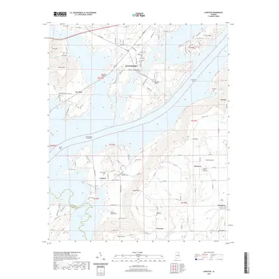
2020 Map of Langston
USGS Topo · Published 2020About this map
Guntersville Lake dominates the central landscape of this Jackson County region, where the sprawling waters meet the rising terrain of Sand Mountain. The settlement of Scottsboro sits to the north, while smaller communities like Langston and Davistown maintain their positions along the shoreline and upland ridges. The distribution of numerous family and church burial grounds, such as Goosepond Cem and Vaught Cem, points to a long-established rural population and deep-seated local lineage across the Tennessee River valley.
Find a feature on this map
138 named features on this map. Tap any name to fly to it.
Don’t see what you’re looking for? This feature index may not catch every label — zoom into the map to look around manually.
Map Details
Editions of this 2020 Langston Map
This is the sole edition of this map. No revisions or reprints were ever made.
Other maps of this area

1885 · Gadsden
USGS Topo · 1:125,000

1886 · Stevenson
USGS Topo · 1:125,000

1888 · Gadsden
USGS Topo · 1:125,000

1888 · Scottsboro
USGS Topo · 1:125,000

1892 · Scottsboro
USGS Topo · 1:125,000

1892 · Stevenson
USGS Topo · 1:125,000

1892 · Gadsden
USGS Topo · 1:125,000

1893 · Fort Payne
USGS Topo · 1:125,000

1895 · Stevenson
USGS Topo · 1:125,000

1895 · Gadsden
USGS Topo · 1:125,000