
1964 Map of Lanham
USGS Topo · Published 1966About this map
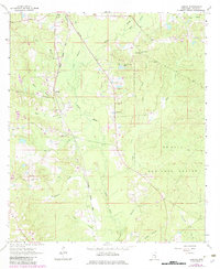
Bogue Homo carves a central path through this section of Jones County, defining a landscape dominated by the timberlands of the De Soto National Forest. In the mid-1960s, the small settlement of Lanham served as a local focal point, situated near the tracks of the Gulf Mobile and Ohio railroad. This corridor shows a mix of rural infrastructure and conservation, with the Point Laurel Lookout Tower and a Fish Hatchery indicating the active management of the forest and its resources during this era.
Find a feature on this map
25 named features on this map. Tap any name to fly to it.
Don’t see what you’re looking for? This feature index may not catch every label — zoom into the map to look around manually.
Map Details
Editions of this 1964 Lanham Map
2 editions found
Other maps of this area

1953 · Hattiesburg
USGS Topo · 1:250,000

1958 · Hattiesburg
USGS Topo · 1:250,000

1963 · Barrontown
USGS Topo · 1:24,000

1964 · Rhodes
USGS Topo · 1:24,000

1964 · Laurel East
USGS Topo · 1:24,000

1964 · Laurel West
USGS Topo · 1:24,000

1964 · Ovett
USGS Topo · 1:24,000

1964 · Ellisville
USGS Topo · 1:24,000

1964 · Myrick
USGS Topo · 1:24,000

1964 · Strengthford
USGS Topo · 1:24,000