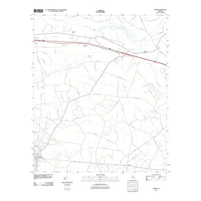
2011 Map of Lanier
USGS Topo · Published 2011About this map
Pembroke serves as a primary hub in this low-lying Georgia landscape, where the confluence of several water bodies defines the local geography. The map reveals an intricate network of waterways including Lower Black Creek, Upper Black Creek, and the winding Ash Branch. These streams carve through the terrain, creating distinct landforms such as Jennett Island and Moonshine Island.
Find a feature on this map
68 named features on this map. Tap any name to fly to it.
Don’t see what you’re looking for? This feature index may not catch every label — zoom into the map to look around manually.
Map Details
Editions of this 2011 Lanier Map
This is the sole edition of this map. No revisions or reprints were ever made.
Other maps of this area

1919 · Egypt
USGS Topo · 1:62,500

1920 · Pembroke
USGS Topo · 1:62,500

1920 · Meldrim
USGS Topo · 1:62,500

1921 · Brooklet
USGS Topo · 1:62,500

1939 · Egypt
USGS Topo · 1:62,500

1942 · Meldrim
USGS Topo · 1:62,500

1943 · Brooklet
USGS Topo · 1:62,500

1943 · Egypt
USGS Topo · 1:62,500

1947 · Savannah
USGS Topo · 1:250,000

1948 · Savannah
USGS Topo · 1:250,000