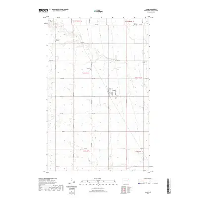
2020 Map of Lankin
USGS Topo · Published 2020About this map
The small municipality of Lankin serves as the central hub of this agricultural region in Walsh County, where a grid of section-line roads like 60th St NE and Co Rd 14 defines the prairie landscape. The drainage of the N Br Forest River provides the primary topographic variation, carving a winding path through the northern townships. This rural area is characterized by its deep-rooted community foundations, evidenced by numerous burial sites and religious landmarks that remain active focal points of the local history.
Find a feature on this map
32 named features on this map. Tap any name to fly to it.
Don’t see what you’re looking for? This feature index may not catch every label — zoom into the map to look around manually.
Map Details
Editions of this 2020 Lankin Map
This is the sole edition of this map. No revisions or reprints were ever made.
Other maps of this area

1952 · Thief River Falls
USGS Topo · 1:250,000

1953 · Devils Lake
USGS Topo · 1:250,000

1956 · Thief River Falls
USGS Topo · 1:250,000

1956 · Devils Lake
USGS Topo · 1:250,000

1957 · Thief River Falls
USGS Topo · 1:250,000

1963 · Edinburg
USGS Topo · 1:24,000

1963 · Pleasant Valley
USGS Topo · 1:24,000

1963 · Fordville
USGS Topo · 1:24,000

1967 · Thief River Falls
USGS Topo · 1:250,000

1971 · Whitman
USGS Topo · 1:24,000