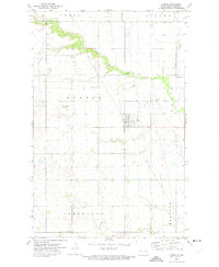
1972 Map of Lankin
USGS Topo · Published 1975About this map
Lankin serves as the primary hub of this eastern North Dakota agricultural landscape, situated at the junction of the Soo Line railroad. The surrounding prairie is organized into established townships including Vesta, Golden, Norton, Vernon, and Cleveland. This organization reflects the systematic land divisions typical of Walsh County's settlement history. For genealogists and local historians, several rural burial sites are documented, such as Pleasant Valley Cem in the north and Machart Cem near the center of the sheet.
Find a feature on this map
17 named features on this map. Tap any name to fly to it.
Don’t see what you’re looking for? This feature index may not catch every label — zoom into the map to look around manually.
Map Details
Editions of this 1972 Lankin Map
This is the sole edition of this map. No revisions or reprints were ever made.
Other maps of this area

1952 · Thief River Falls
USGS Topo · 1:250,000

1953 · Devils Lake
USGS Topo · 1:250,000

1956 · Thief River Falls
USGS Topo · 1:250,000

1956 · Devils Lake
USGS Topo · 1:250,000

1957 · Thief River Falls
USGS Topo · 1:250,000

1963 · Edinburg
USGS Topo · 1:24,000

1963 · Pleasant Valley
USGS Topo · 1:24,000

1963 · Fordville
USGS Topo · 1:24,000

1967 · Thief River Falls
USGS Topo · 1:250,000

1971 · Whitman
USGS Topo · 1:24,000