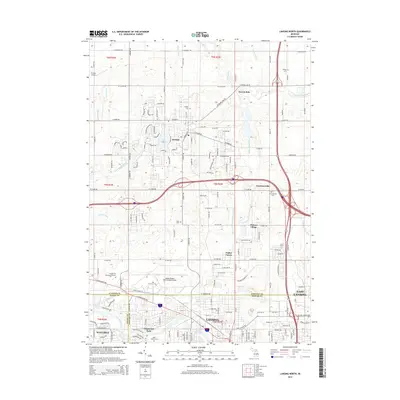
2014 Map of Lansing North
USGS Topo · Published 2014About this map
Lansing and its northern suburban reaches are defined by the convergence of the Grand River and the Looking Glass River in this detailed 2014 topographic study. The map captures a transitional landscape where the urban density of Waverly and East Lansing gives way to established residential communities like Valley Farms, Edgemont Park, and Clinton Village. Significant infrastructure dominates the central-western portion of the map, anchored by the Capital Region International Airport and the smaller Zischke Airport. To the north, the city of DeWitt and East DeWitt are separated from the main urban center by the intricate drainage systems of Prairie Cr and Gunderman Lake Drain and Remey Chandler Drain. For those researching local heritage, the map identifies several historic burial sites, including the Wilsey Cem, Hurd Cem, and the sprawling Chapel Hill Memorial Gardens, providing precise locations for family history and land-use research.
Find a feature on this map
132 named features on this map. Tap any name to fly to it.
Don’t see what you’re looking for? This feature index may not catch every label — zoom into the map to look around manually.
Map Details
Editions of this 2014 Lansing North Map
This is the sole edition of this map. No revisions or reprints were ever made.
Other maps of this area

1909 · Mason
USGS Topo · 1:62,500

1910 · Lansing
USGS Topo · 1:62,500

1911 · Mason
USGS Topo · 1:62,500

1912 · Lansing
USGS Topo · 1:62,500

1927 · De Witt
USGS Topo · 1:62,500

1928 · Laingsburg
USGS Topo · 1:62,500

1944 · Laingsburg
USGS Topo · 1:62,500

1958 · Grand Rapids
USGS Topo · 1:250,000

1961 · Grand Rapids
USGS Topo · 1:250,000

1962 · Grand Rapids
USGS Topo · 1:250,000