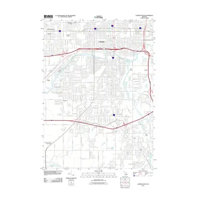
2011 Map of Lansing South
USGS Topo · Published 2011About this map
The Grand River and Red Cedar River converge in this 2011 survey, defining the industrial and residential heart of the state capital. The suburban expansion south of Lansing is evidenced by the established neighborhoods of Edgemont Park, Waverly, and Holt. This map is particularly valuable for genealogical research, as it captures a wide array of burial grounds including the sprawling Mount Hope Cemetery, Evergreen Cemetery, and smaller local sites like North Cemetery and Pioneer Cemetery. The landscape transitions from the urban core toward the Mud Lake area, where the drainage network including the Cook and Thorburn Drain begins to shape the geography. Prominent community features like the Groesbeck Municipal Golf Course and Frances Park illustrate the planned green spaces amidst the region's dense transportation corridor.
Find a feature on this map
142 named features on this map. Tap any name to fly to it.
Don’t see what you’re looking for? This feature index may not catch every label — zoom into the map to look around manually.
Map Details
Editions of this 2011 Lansing South Map
This is the sole edition of this map. No revisions or reprints were ever made.
Other maps of this area

1909 · Mason
USGS Topo · 1:62,500

1910 · Lansing
USGS Topo · 1:62,500

1911 · Mason
USGS Topo · 1:62,500

1912 · Lansing
USGS Topo · 1:62,500

1927 · De Witt
USGS Topo · 1:62,500

1928 · Laingsburg
USGS Topo · 1:62,500

1944 · Laingsburg
USGS Topo · 1:62,500

1958 · Grand Rapids
USGS Topo · 1:250,000

1961 · Grand Rapids
USGS Topo · 1:250,000

1962 · Grand Rapids
USGS Topo · 1:250,000
Featured Places
- Lansing, MI
- East Lansing, MI
- Edgemont Park, MI
- Windsor Charter Township, MI
- Lansing Charter Township, MI