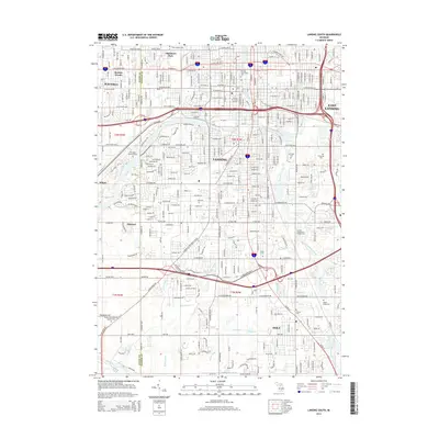
2014 Map of Lansing South
USGS Topo · Published 2014About this map
The Grand River and Red Cedar River converge in the heart of Lansing, shaping the urban geography of Michigan’s state capital during the mid-2010s. This survey details the transition from the dense downtown core, featuring institutions like Lansing Community College and the Thomas M. Cooley Law School, to the sprawling southern suburbs and specialized districts. To the west, Waverly and Bretton Woods represent mid-century residential growth, while the eastern edge highlights the reach of East Lansing.
Find a feature on this map
69 named features on this map. Tap any name to fly to it.
Don’t see what you’re looking for? This feature index may not catch every label — zoom into the map to look around manually.
Map Details
Editions of this 2014 Lansing South Map
This is the sole edition of this map. No revisions or reprints were ever made.
Other maps of this area

1909 · Mason
USGS Topo · 1:62,500

1910 · Lansing
USGS Topo · 1:62,500

1911 · Mason
USGS Topo · 1:62,500

1912 · Lansing
USGS Topo · 1:62,500

1927 · De Witt
USGS Topo · 1:62,500

1928 · Laingsburg
USGS Topo · 1:62,500

1944 · Laingsburg
USGS Topo · 1:62,500

1958 · Grand Rapids
USGS Topo · 1:250,000

1961 · Grand Rapids
USGS Topo · 1:250,000

1962 · Grand Rapids
USGS Topo · 1:250,000
Featured Places
- Lansing, MI
- East Lansing, MI
- Edgemont Park, MI
- Windsor Charter Township, MI
- Lansing Charter Township, MI