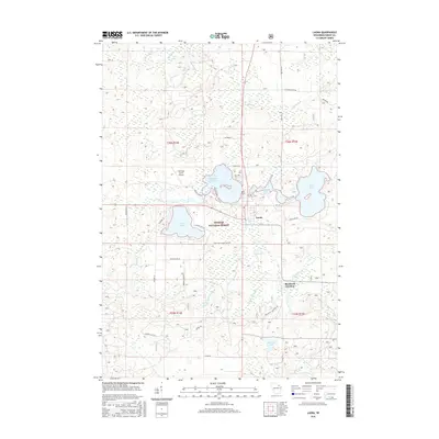
2015 Map of Laona
USGS Topo · Published 2015About this map
Nicolet National Forest encompasses the vast majority of this landscape, where the settlement of Laona serves as a primary hub. The terrain is defined by an intricate network of glacial lakes and waterways, including Silver Lake, Birch Lake, and the uniquely named Scattered Rice Lake. Just south of the main township, Blackwell Junction reflects the area's history of intersecting transit lines. Genealogists and local historians can locate the Laona Cem and trace old family-named routes such as Starks Settlement Rd and Connor Farm Rd. Smaller water bodies like Spring Pond and Kazmier Lake are tucked among the timberlands, while the Rat River and numerous creeks like Camp Eight Cr and Whiting Cr drain the forest floor. The presence of Heritage Acres Airport north of the main settlement indicates the modern infrastructure supporting this remote timber and recreation region.
Find a feature on this map
41 named features on this map. Tap any name to fly to it.
Don’t see what you’re looking for? This feature index may not catch every label — zoom into the map to look around manually.
Map Details
Editions of this 2015 Laona Map
This is the sole edition of this map. No revisions or reprints were ever made.
Other maps of this area

1939 · Crandon
USGS Topo · 1:48,000

1939 · Laona
USGS Topo · 1:48,000

1941 · Crandon
USGS Topo · 1:48,000

1942 · Wabeno
USGS Topo · 1:48,000

1942 · Pearson
USGS Topo · 1:48,000

1946 · Laona
USGS Topo · 1:48,000

1947 · Crandon
USGS Topo · 1:48,000

1950 · Wabeno
USGS Topo · 1:48,000

1950 · Lily
USGS Topo · 1:48,000

1951 · Wabeno
USGS Topo · 1:48,000